Aerial & Drone Photography FAQ for 2026
Part 107, the rule changes that actually matter, common pitfalls, and how to vet a UAV operator.
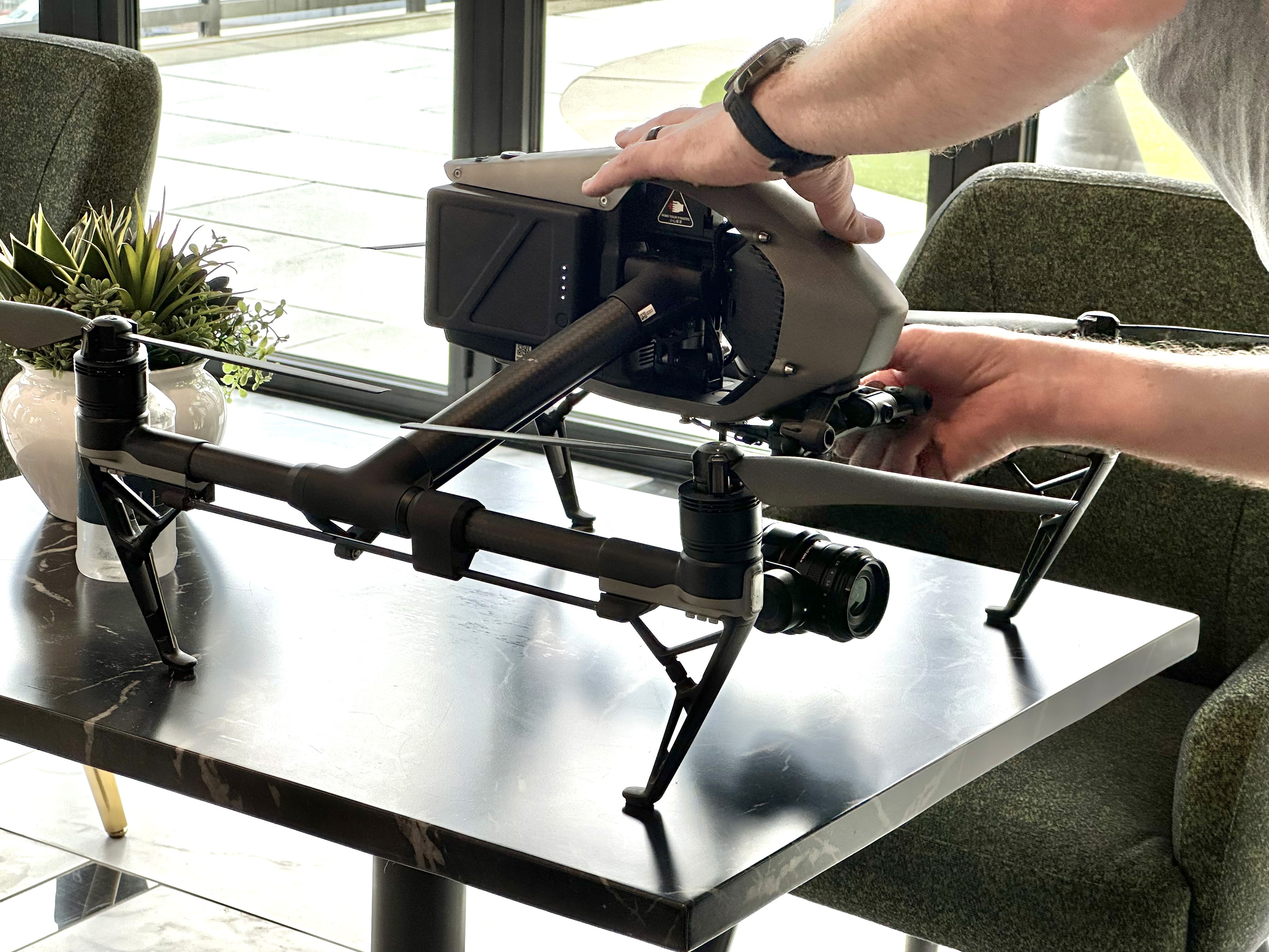
Aerial photography has been part of commercial architectural work long enough that most firms no longer treat it as a novelty. What has changed is the regulatory environment around it, which moved more in the last eighteen months than in the five years before that. If you are commissioning drone photography or video for a building, a development, or a property portfolio in 2026, here is what actually matters, what does not, and how to tell a professional operator from someone with a good camera and a hobbyist's understanding of the rules.
Frequently asked questions
Does commercial drone work still require a Part 107 certificate?
Yes. Part 107 remains the operative rule for commercial small unmanned aircraft operations in the United States, and nothing proposed or pending in 2026 changes that for the kind of work architectural and property photography involves. Any flight conducted for a business purpose, including photography you intend to publish, market with, or hand to a client, requires a Remote Pilot Certificate with a small UAS rating. There is no recreational carve-out for a paid shoot, and no threshold below which it stops applying.
A current certificate also means current recurrent training. Remote pilots have to complete an FAA recurrent training course every twenty-four calendar months. A certificate issued in 2019 and never refreshed is not a current certificate, and an operator who cannot tell you when they last completed recurrent training probably has not.
What is Part 108, and does it affect my project?
Part 108 is the FAA's proposed framework for routine beyond visual line of sight operations, meaning flights where the pilot cannot see the aircraft. It has been the most-discussed item in commercial drone regulation for two years. The proposed rule was published in August 2025, drew roughly three thousand comments, had a limited comment period reopened in early 2026 on the contested right-of-way and electronic conspicuity provisions, and reached the Office of Information and Regulatory Affairs for final review in July 2026.
As of this writing it is still a proposal. No operator can claim Part 108 authority, and beyond visual line of sight flight still requires a Part 107 waiver with a specific safety case. Industry expectation is a published final rule in late 2026 or early 2027, followed by a transition period before requirements take effect.
For architectural and property photography, the practical answer is that Part 108 changes very little. Photographing a building means flying within sight of it. The operations Part 108 is designed to unlock, such as pipeline inspection, agricultural survey, corridor mapping, and delivery, are not what your project needs. If a vendor is selling you on Part 108 capability for a building shoot, they are selling you something you do not require and cannot currently receive.
What about the drone ban I keep reading about?
This one causes more confusion than any other topic, so it is worth being precise.
A provision of the fiscal year 2025 National Defense Authorization Act required a federal national security agency to complete a formal review of certain Chinese drone manufacturers by December 23, 2025. No agency completed one. In late December 2025, rather than listing only the two named manufacturers, an interagency national security determination and a subsequent FCC public notice added foreign-produced unmanned aircraft systems and their critical components to the FCC's Covered List, with clarifying guidance and exemptions issued in January 2026.
What that does: it blocks new FCC equipment authorizations for covered aircraft, which effectively prevents new foreign-made models from entering the U.S. market. What it does not do: ground anything. Aircraft that already received FCC authorization remain legal to own, legal to fly, and legal to sell through authorized channels. There is no remote disable mechanism. The FCC has also extended the window for firmware and security updates on existing equipment.
For a client commissioning photography, the practical effect in 2026 is narrow. Your operator's fleet should be legally acquired and FCC-authorized, and they should be able to say so plainly. Beyond that, the Covered List is a supply-chain and procurement story, not a flight-legality story. Do note that some federal, state, and institutional clients maintain their own procurement restrictions on specific manufacturers that are stricter than the FCC's, and those restrictions can flow down to vendors. If your project involves a government facility, a defense contractor, or a public university, raise it early.
Can you legally fly at my site?
Usually, but not always, and the honest answer requires looking first. Dallas-Fort Worth is one of the more congested airspace environments in the country. Between DFW International, Love Field, Alliance, Addison, Dallas Executive, and a dense layer of regional and general aviation fields, a large share of the metroplex sits inside controlled airspace.
Controlled airspace is not a prohibition, it is an authorization requirement. Most of it can be cleared through LAANC, the automated system that grants near-immediate approval up to a published ceiling for a given grid square. Where LAANC helps least is close to a runway, where the published ceiling may be very low or zero. Those sites require a manual authorization request through the FAA, which is measured in weeks or months, not minutes. There are also standing national security flight restrictions and temporary restrictions that appear with little notice around large events and visiting officials.
The operator's job is to check this before a date is on the calendar, not on the morning of the shoot. If a site cannot be flown legally, you should hear it in the proposal.
Can you shoot at dusk or at night?
Yes. Night operations have been permitted under Part 107 since 2021, provided the aircraft carries anti-collision lighting visible for three statute miles and the pilot has completed the applicable training. This matters more than it sounds, because the best exterior architectural aerials are frequently made in the twenty minutes after sunset, when interior lighting balances against the remaining sky. Any operator who tells you they cannot fly at dusk is telling you about their own limitations, not the regulations.
Can you fly over the parking lot while people are in it?
Flight over people is regulated by category, and eligibility depends on the aircraft's weight, its injury-risk characteristics, and in some categories a manufacturer declaration and labeling. Flight over moving vehicles carries its own restrictions. Most professional camera aircraft are not eligible for unrestricted operations over crowds.
In practice this rarely limits an architectural shoot. It does mean the operator should be planning launch points, flight paths, and timing around where people actually are, and should be willing to coordinate a brief pause in an active area rather than simply flying over it and hoping.
Does the FAA control whether I can launch from my own property?
No, and this distinction trips people up. The FAA regulates the airspace. It does not regulate the ground. Takeoff and landing from a given piece of property is a matter of property permission, plus whatever state law, municipal ordinance, or park rule applies to that specific parcel.
This is why a competent operator asks who controls the ground before the shoot. Launching from a public sidewalk, a neighboring property, a city park, or a construction staging area each carry different permission requirements, and getting told to pack up mid-shoot by a property manager who was never told you were coming is an avoidable waste of a light window.
Who owns the aerial images?
The same way ownership works for any other commissioned photography. The photographer holds copyright, and you receive a license covering specific, defined uses. Aerial frames are not a separate category and should not carry separate surprise fees when a project goes to an award jury or a publication. Get the licensing terms in writing before the shoot, and make sure they cover the uses you actually anticipate.
Common pitfalls to avoid
Hiring an uncertificated operator to save money. The savings are real and the exposure is worse. An uncertificated commercial flight is an FAA violation, and it typically voids whatever insurance the operator claims to carry. It can also cloud the usage rights on every frame produced. If a claim, a complaint, or a publication rights question surfaces later, the firm that commissioned the work is the one holding it.
Assuming a portfolio of drone footage means architectural competence. Flying well and photographing buildings well are different skills. A great deal of aerial work in the market is technically clean and compositionally meaningless: high, centered, and evenly lit, showing that a building exists without saying anything about it. The frames that get published are usually low, oblique, and shot at a specific hour.
Booking the date before the sun study. Aerial work is more light-dependent than ground work, not less, because you cannot supplement it. A west-facing elevation shot at ten in the morning will be flat no matter how good the aircraft is. The flight window should be chosen from the building's orientation and the season, then the calendar should accommodate it.
Treating aerial as a separate deliverable. When aerial and ground coverage come from different vendors, or from the same vendor on different days with no color discipline, it shows immediately. Skies do not match, white balance drifts, and the set reads as two shoots stapled together. Aerial frames should be corrected and graded to sit alongside the ground coverage from the same project.
Accepting unretouched files. Drone cameras produce visible barrel distortion and converging verticals on architectural subjects. Straight-out-of-camera aerial files of a building almost always show a leaning facade and a bowed roofline. Perspective and lens correction are not optional finishing touches on this work, they are the difference between a photograph and a snapshot from altitude.
Leaving usage undefined until after delivery. The awkward conversation is always the one that happens after a magazine has already scheduled a feature. Define the license scope in the proposal.
Not asking for a certificate of insurance. A verbal assurance of coverage is not coverage. Property managers, general contractors, and institutional owners will frequently require a COI naming them, and finding out on shoot day that your operator cannot produce one costs you the day.
Scheduling a single date for a wind-sensitive shoot. Small aircraft have real wind limits, and North Texas spring afternoons routinely exceed them. A professional builds a weather contingency date into the schedule rather than flying in marginal conditions and delivering soft frames.
What to look for in a good UAV operator
A useful screening conversation covers most of this in ten minutes. The answers should come quickly and without defensiveness.
A current Part 107 certificate, offered without being asked twice. Including the date of their most recent recurrent training.
Commercial general liability with drone coverage, and the ability to issue a COI naming your firm, the property owner, or the general contractor as required, before the shoot date.
Remote ID compliant, legally acquired aircraft. They should be able to tell you what they fly and confirm its compliance status without hedging.
Airspace fluency specific to your site. Ask what airspace your property sits in. A professional will either know or will check and come back with a specific answer, including whether authorization is automated or needs a manual request with lead time.
A portfolio of your building type, not just aerial footage in general. Multifamily, industrial, retail, healthcare, and institutional projects each read differently from the air.
Evidence they understand architectural correction. Ask to see a before-and-after, or simply look closely at their published work for leaning verticals.
Written licensing terms in the proposal. Scope, duration, and channels, defined before the shoot rather than negotiated after.
A pre-flight plan that includes people, not just aircraft. Who they will coordinate with on site, where they will launch, and how they will handle an active work zone or an occupied property.
A specified deliverable. Resolution, file formats, how many finished selects, and turnaround. Vagueness here reliably becomes disappointment later.
Willingness to tell you no. The single most reliable signal. An operator who says a site cannot be flown legally, or that a requested angle is not achievable within the rules, is the one who will not put your project in an awkward position.
The short version
Part 107 still governs the work. Part 108 is coming but is not here, and would not change a building shoot much if it were. The FCC action on foreign-made aircraft restricts what can newly enter the market and does not ground anything already flying. Everything else that determines whether your aerial photography is worth the line item comes down to the same things that determine it on the ground: planning, light, judgment about what a frame needs to communicate, and finishing the files properly.
Regulations continue to move. Anything time-sensitive in this article is worth confirming at faa.gov/uas or with your operator before a shoot is scheduled.
Planning aerial coverage for a project in Dallas-Fort Worth or elsewhere in Texas?
Tell us about the site and the deadline. We will confirm the airspace situation and what is achievable before anything goes on the calendar.
About the author
Sean Gallagher has photographed architectural projects for AIA submissions, editorial publications, and development marketing across Texas for over 20 years.
Work with us
We work with architecture firms, interior designers, and developers across Dallas–Fort Worth and Texas. Contact us to discuss your project.
Get in touch →